English
 Deutsch
 Slovensky
 Italiano
 Français
 Español
 Português
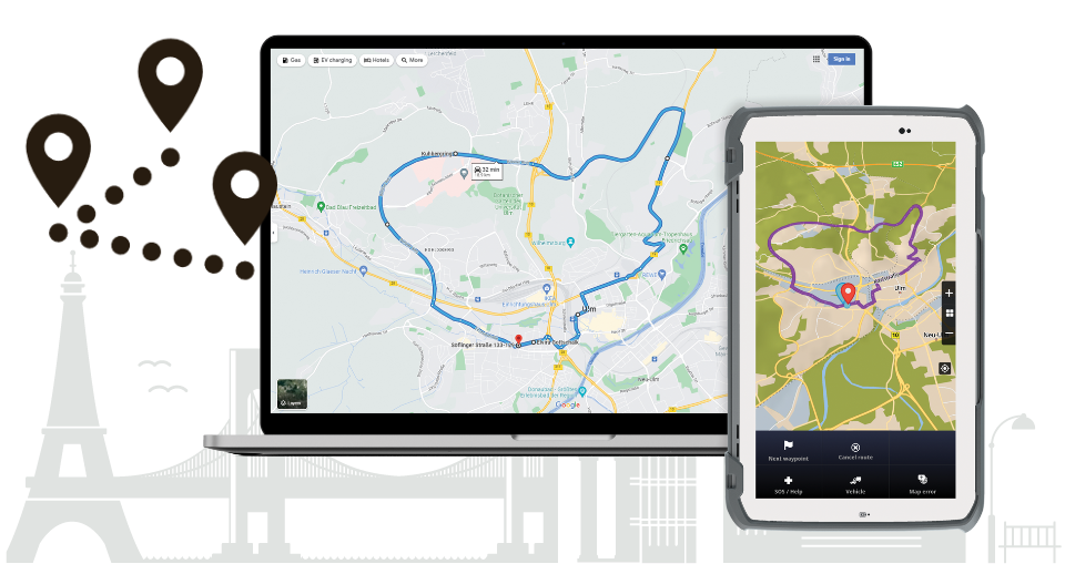
Sygic Professional Navigation avoids discrepancies between planned and traveled kilometers/miles thanks to its Guided Routes feature. This feature lets you import routes from your planning tool into the navigation app to get the drivers to follow the route precisely as planned. It suppresses the Sygic routing algorithm and shows the route scheduled at the office. An example of where this can be helpful is the waste management service, where the vehicle sometimes needs to go off-road or into a forbidden zone.
Estimating road transport costs per km/mile
In the transportation business, the price per delivery is usually agreed upon and based on kilometers driven. And when the invoice comes, the customer expects it to be the same as the approved cost. Therefore, transportation requires not only precise planning but also precise execution of the planned route. If the driver were to take a different route than intended by the dispatcher, there could be discrepancies in billing and problems for the driver, the dispatcher, and the customer.
Sygic Professional Navigation has a feature called "Guided routes", also known as Precomputed Routes, which allows the Sygic Professional Navigation app to load the routes created in an external system. The driver can follow the route precisely as planned by a 3rd party planning or optimization tool, avoiding undesired driving deviations.
We support various import formats – .bcr, .sif, .omc, or commonly used .json generated by external tools such as PTV xServer. The navigation does not use its routing algorithms and follows the geometry and instructions the planning tool provides.
The result is that the planned route matches the route traveled, costs are controlled, and drivers are always where they should be.
The application passed the test
Even if this sounds straightforward, it is a complicated piece of software engineering, and we asked some of our main integrating partners to test this new file extension for us.
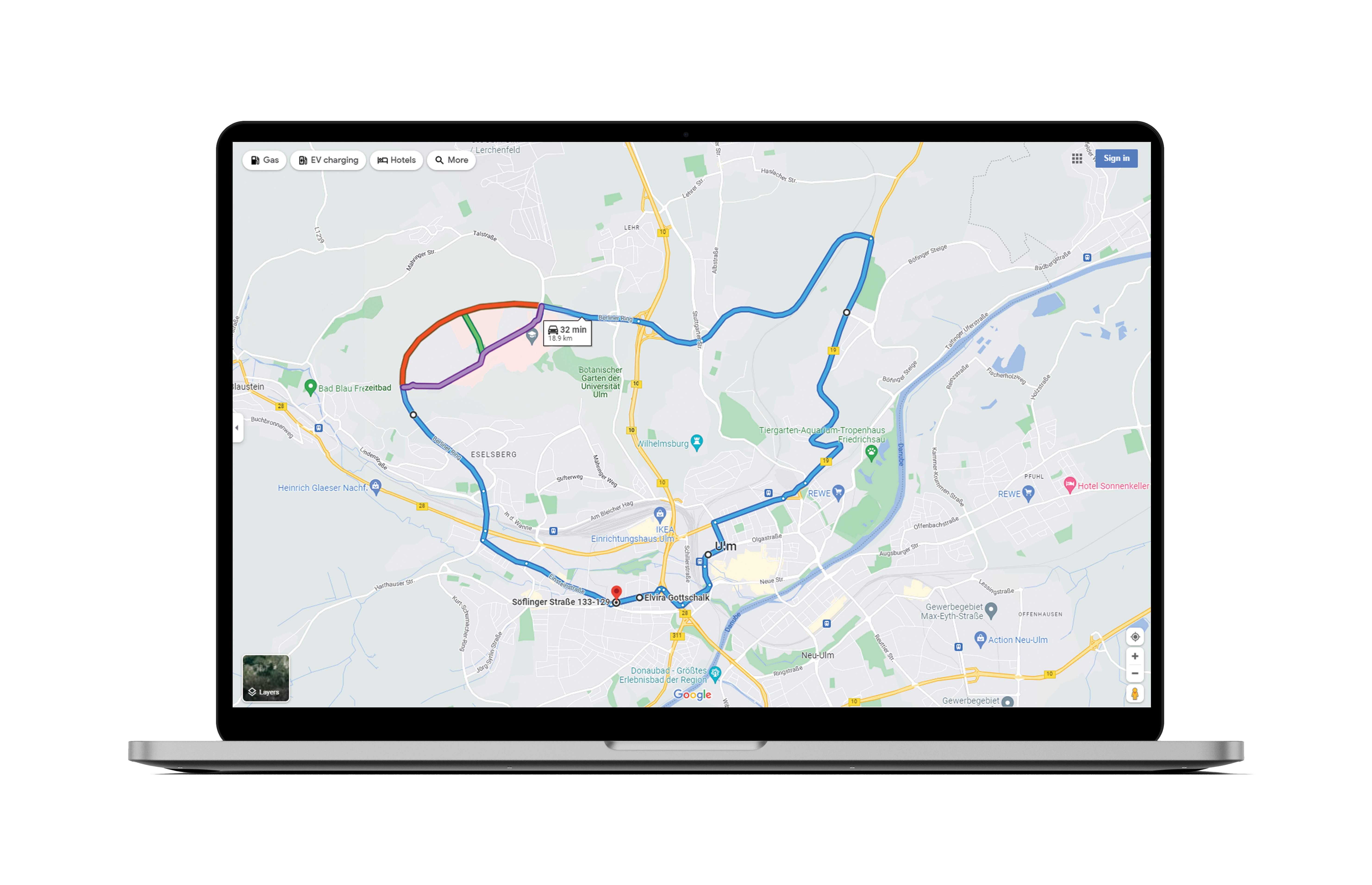
In the following example, the dispatcher wants to create a route from Söflinger str. 100 to Anne-Frank Weg 6 in Ulm and the way back to Söflingerstr. 100. This is how Google Maps computes the route. 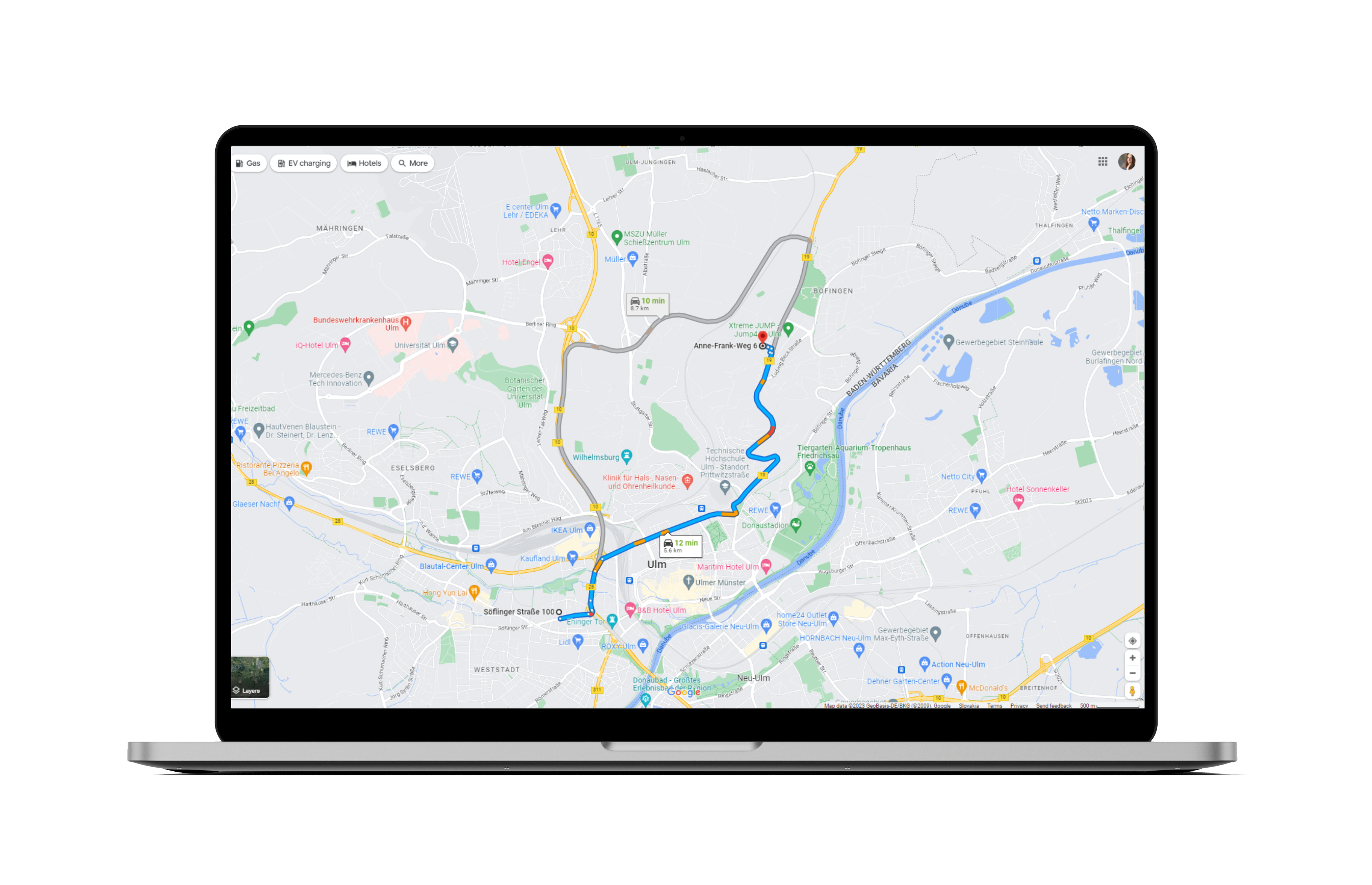
The dispatcher is not satisfied with that route and uses some waypoints to alter the computation:
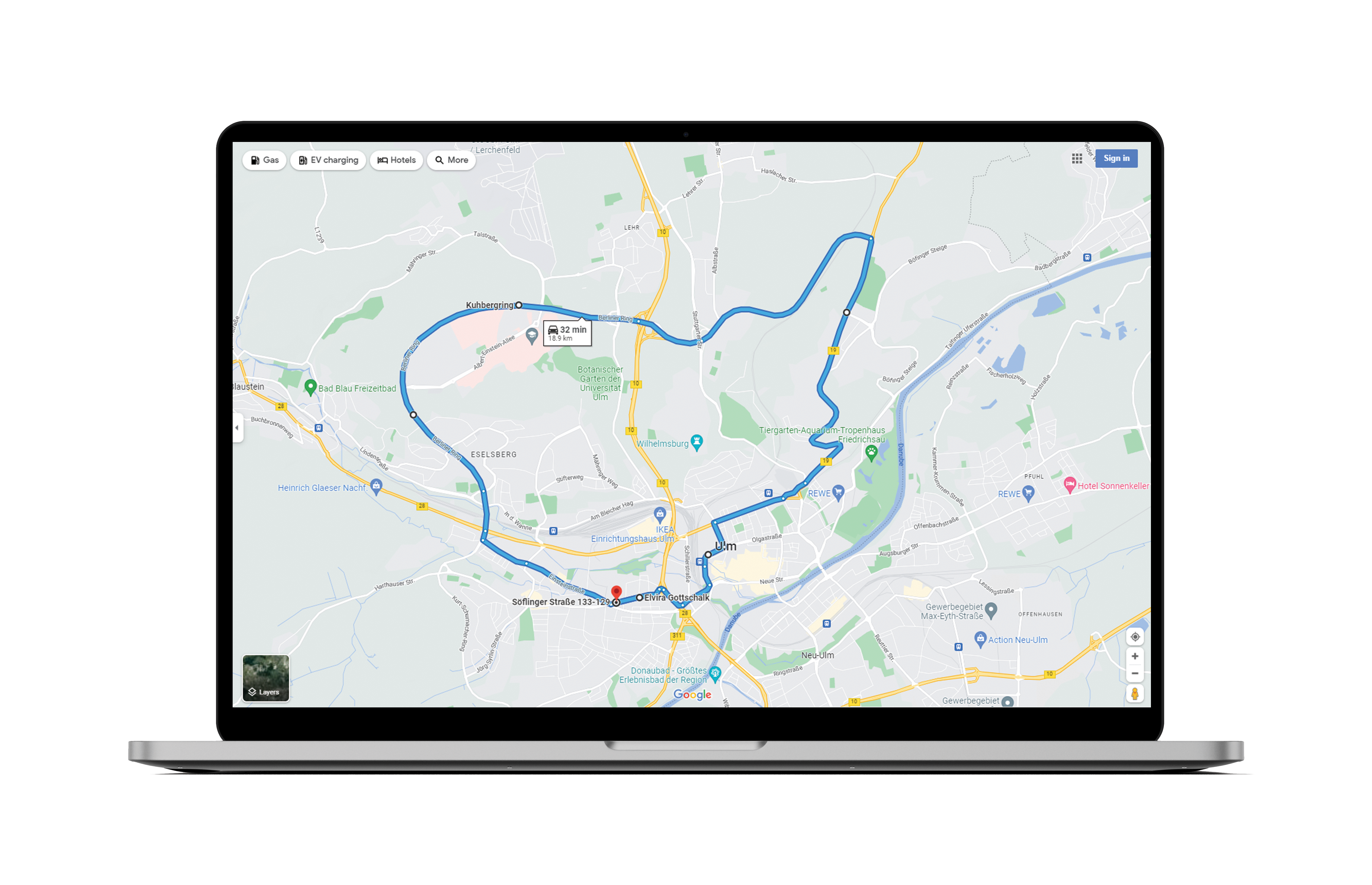
This route was sent to Sygic Professional Navigation. Söflingerstr. 100 was set as the start point, Anne-Frank Weg 6 in Ulm as a waypoint, and Söflingerstr. 100 as the endpoint. All other points between are magnetic waypoints. They are less than 500m far away.
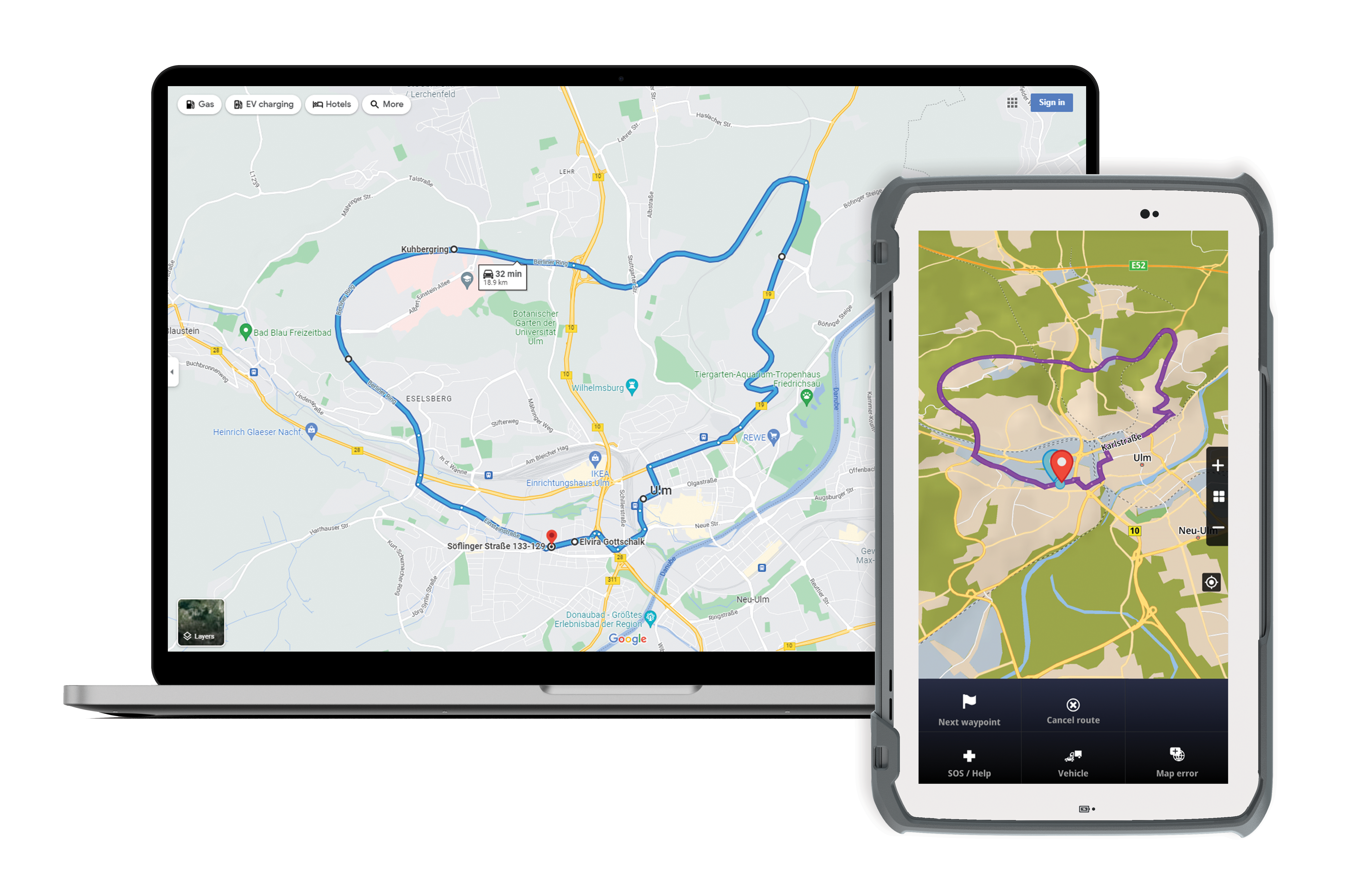
This is the result
Sygic did an excellent job and didn't compute the route back to the next magnetic waypoint. It tried to get us back (green line) to the "Berliner ring", but we drove straight on purpose. It calculates the correct route to the next waypoint to "Anne-Frank-Weg".
Technical details
The guided route is a sequence of GPS positions, possibly extended with waypoints indicating significant points on the route. Such routes can be loaded into the navigation using the SDK function LoadComputedRoute.
Sygic navigation internally runs the route approximation algorithm, which performs map matching of that GPS sequence to currently installed Sygic maps to generate a navigable route. Once the route is generated, Sygic navigation follows the route. If a driver leaves the planned route, the navigation will guide him back to the planned route in the most efficient way.
The documentation and list of supported file formats are available here.
Over to you
Contact us today to try this feature and others that can help you navigate the roads safely.