- Developers
- Sygic Maps API
- Analytics API
- Map matching
Map matching
- Move to section
Map matching lets you snap sets of GPS points to the road network with very high accuracy. Only POST method is supported.
API endpoint
https://analytics.api.sygic.com/v1/api/matchingParameters
To create a valid request, path OR coordinates must be included in the request.
| Parameters | Data type | Values | Descripion |
| path | string | Path is a representation of sets of GPS positions using Google polyline encoding utility. This method is more compact than listing all GPS coordinates. Example: "path": "c~ffH}okjBeAmJ" |
|
| coordinates | array of strings | {latitude},{longitude} | Set of GPS coordinates for map matching. Example: "coordinates": ["48.37362,17.595033","48.37397,17.59686"] |
| accuracies | array of decimal values | Set of radiuses of uncertainty for the corresponding locations, measured in meters. This field is not required. When is omitting we will use default values for best results. Example: "accuracies": [9.5,10] |
|
| timestamps | array of integers | array of UTC time | Set of timestamps in seconds since midnight, January 1, 1970 UTC. Example: "timestamps":[1464691627,1464691698] |
| units | string | array of UTC time | Set of timestamps in seconds since midnight, January 1, 1970 UTC. Example: "timestamps":[1464691627,1464691698] |
The number of accuracies and timestamps must match number of coordinates.
Parameters with default value don't have to be included in the request.
| Default parameter | Type | Default | Value | Description |
| units | string | metric | metric imperial |
Units’ format. |
Request
Example body with path:
{
    "path": "wsfxHzxsC??@FFv@EZu@~@???@aDzAKAm@HCPF^V^t@ZvFgE`KmLjEuH??NE^NNNzBz@VIjAmBiCcUcH_YuIsXaKeXyKwWgLcVoLmU",
    "accuracies": [
        9,9,10,10,10,11,11,11,11,10,11,11,11,11,11,10,10,10,10,10,10,9,11,10,11,11,11,11,11,11,11,9
    ]
}
Example body with coordinates:
{
    "coordinates": [
        "51.321075,-0.7619",
        "51.321075,-0.7619",
        "51.32107,-0.761935",
        "51.321026,-0.76222",
        "51.321056,-0.762356",
        "51.321327,-0.762678",
        "51.321327,-0.762678",
        "51.321335,-0.762686",
        "51.322136,-0.763151",
        "51.322205,-0.763136",
        "51.32243,-0.76319",
        "51.322445,-0.763276",
        "51.322407,-0.763443",
        "51.32229,-0.763601",
        "51.322025,-0.763736",
        "51.320778,-0.762741",
        "51.318855,-0.760593",
        "51.317833,-0.759043",
        "51.317833,-0.759043",
        "51.317753,-0.759006",
        "51.317585,-0.759088",
        "51.31751,-0.759166",
        "51.31689,-0.759473",
        "51.316772,-0.759421",
        "51.316387,-0.758868",
        "51.317085,-0.755328",
        "51.31854,-0.751173",
        "51.320248,-0.74707",
        "51.322178,-0.74304",
        "51.32423,-0.739085",
        "51.326355,-0.735376",
        "51.32851,-0.731793"
    ],
    "accuracies": [
        9,9,10,10,10,11,11,11,11,10,11,11,11,11,11,10,10,10,10,10,10,9,11,10,11,11,11,11,11,11,11,9
    ]
}
Response
{
    "route": "krfxHzzsC??eBnB]J[Cc@n@sAGYZEj@JLFZj@^hAOzAgAtAiAhGyGxEsGjB_D?ML_@\\AHLt@p@r@VPDh@Il@i@Xi@Pu@FyAEY}@}HY{ASaAI_@OmAaB_HeCwJ
        _@qA{B{HGWsF{PqCeIuCsHuEiL}CoHwCwGwLgWeK}R",
    "distance": {
        "value": 3349,
        "text": "3.35 km"
    },
    "status": "OK",
    "copyright": "© 2018 Sygic a.s."
}
Route format
Sygic Routing API is using Google Encoded Polyline that stores a series of coordinates into a single string. More information about Encoded Polyline can be found on this link.
Tool for visualization of the Google Encoded Polyline can be found on this link.
Make sure to always escape the backslashes in encoded strings! Not doing so will result in the backslash to be interpreted as an escape character, yielding either wrong polyline or a polyline that can't be decoded. This problem will not occur if the polylines are passed around programatically in memory.
Polyline below is encoded from two coordinates "41.6076,-88.21549","41.60745,-88.21537":
on}|FxqlyO\Wit contains characters ['o', 'n', '}', '|', 'F', 'x', 'q', 'l', 'y', 'O', '\', 'W'], therefore if used as string literal in code, it has to be declared as:
var polyline = "on}|FxqlyO\\W";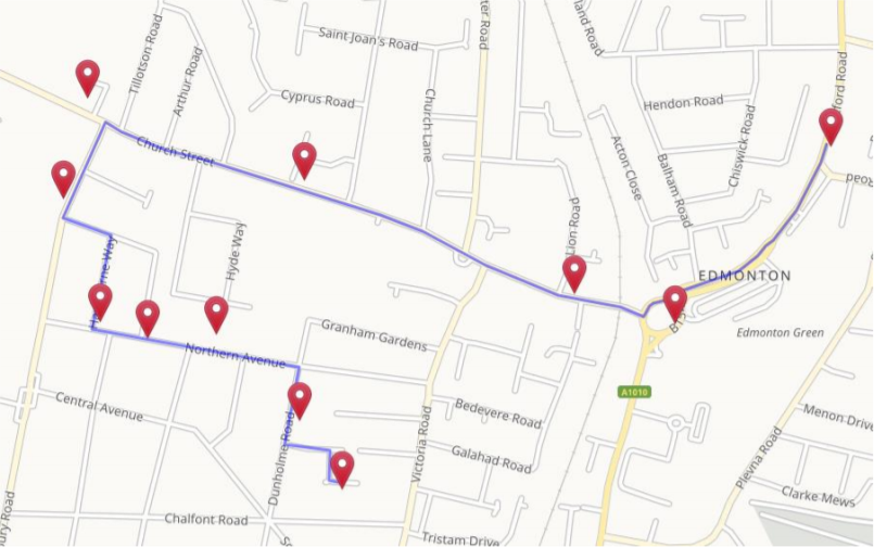
Overview
Map matching lets you snap sets of GPS points to the road network with very high accuracy.
Live Example
This example demonstrates the use of the Map matching service. Click on icons to see code on Github or play with it in JSFiddle:

Request
API Reference
https://analytics.api.sygic.com/v1/api/matching?key=yourAPIkeyRequest authentication is done via parameter key, which must be included in the request URL.
Methods
- POST
Parameters
Required Parameters
To create a valid request, path OR coordinates must be included in the request.
| Parameter | Data type | Description |
| path | string | Path is a representation of sets of GPS positions using Google polyline encoding utility. This method is more compact than listing all GPS coordinates. Example: "path": "c~ffH}okjBeAmJ" |
| coordinates | array of strings | Set of GPS coordinates for map matching. Example: "coordinates": ["48.37362,17.595033","48.37397,17.59686"] |
Optional Parameters
| Parameter | Data type | Description |
| accuracies | array of decimal values | Set of radiuses of uncertainty for the corresponding locations, measured in meters. This field is not required. When is omitting we will use default values for best results. Example: "accuracies": [9.5,10] |
| timestamps | array of integers | Set of timestamps in seconds since midnight, January 1, 1970 UTC. Example: "timestamps":[1464691627,1464691698] |
| units | string | Units' format. Default value is "metric". Values: metric, imperial |
The number of accuracies and timestamps must match number of coordinates.
Response
POST
POST https://analytics.api.sygic.com/v1/api/matching?key=yourAPIkey

Content-Type: application/json
Example request body with path:
{
    "path": "u{ydH}dogBp@oEj@eSd@eQCqC}QeJw@sAAqANwGq@mFiFi]aFg^m@eD`AALM^kB",
    "accuracies": [9,9,10,10,9,10,9,10,11,11,9,10,10,9,9,11]
}
Example request body with coordinates:
{
    "coordinates": [
        "48.14283,17.12223",
        "48.14258,17.12327",
        "48.14236,17.12650",
        "48.14217,17.12941",
        "48.14219,17.13014",
        "48.14522,17.13193",
        "48.14550,17.13235",
        "48.14551,17.13276",
        "48.14543,17.13416",
        "48.14568,17.13535",
        "48.14685,17.14020",
        "48.14798,17.14520",
        "48.14821,17.14603",
        "48.14788,17.14604",
        "48.14781,17.14611",
        "48.14765,17.14665"
        ],
    "accuracies": [9,9,10,10,9,10,9,10,11,11,9,10,10,9,9,11]
}
Both of the above requests produce the same result.
Response Body
{
    "route": "s{ydH{dogB@EDQPw@Hs@XwGFmABsALgFNyEFqBH{C@mAB}A@qA@k@YOIEo@]cAg@oL_GIEi@c@a@aBBi@JmCC{CI}@DSOyAOu@Yo@G_@Ga@]{BKm@s@aFIg@My@i@kDo@mE_@_Ce@gD]{BEW_@uB[oBM{@CU_AaHSwAhAKJ]ZmA",
    "status": "OK",
    "distance": {
        "value": 2130,
        "text": "2.13 km"
    },
    "copyright": "© 2018 Sygic a.s."
}- Next article: Speeding report