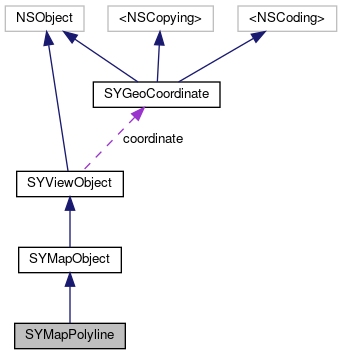
SYMapObject in the shape of a polyline. In order to display the polyline object on the map, the polyline object needs to be added to an SYMapView by calling addMapObject: More...
#import <SYMapObjects.h>
Instance Methods | |
| (nonnull instancetype) | - initWithCoordinates: |
| Initializes a SYMapPolyline instance with the specified SYGeoCoordinates. More... | |
| (instancetype) | - initWithSdkPolyline: [implementation] |
 Instance Methods inherited from SYMapObject Instance Methods inherited from SYMapObject | |
| (instancetype) | - initWithCoordinate:type:payload: [implementation] |
| (Sygic::Map::MapObject *) | - sdkMapObject [implementation] |
| Instance Methods inherited from SYViewObject | |
| (instancetype) | - initWithCoordinate:baseType: [implementation] |
| (instancetype) | - initWithCoordinate:baseType:payload: [implementation] |
Properties | |
| NSArray< SYGeoCoordinate * > * | vertices |
| The SYGeoCoordinate array that comprise the path of the SYMapPolyline. More... | |
| NSUInteger | lineWidth |
| The line width, in pixels. More... | |
| UIColor * | primaryColor |
| The line color. More... | |
| UIColor * | secondaryColor |
| The sceondary color used as second color on dashed line or as border color. More... | |
| BOOL | dashed |
| Indicates whether the SYMapPolyline is dashed. More... | |
| BOOL | hasScalableWidth |
| Indicates whether the width od SyMapPolyline is scaled based on ground distance. More... | |
| BOOL | hasBorders |
| Indicates whether the SyMapPolyline should be rendered with borders. More... | |
| NSUInteger | dashLength |
| The length of the dash segment of the SYMapPolyline. More... | |
| NSUInteger | dashSecondaryLength |
| The length of the secondary dash segment of the SYMapPolyline. More... | |
| NSUInteger | cornerRadius |
| Corner radius for the dash segment of the SYMapPolyline, in range [0, lineWidth / 2]. Corner radius of size lineWidth / 2 generates circled pattern, otherwise rectangle with rounded corners is generated. More... | |
| std::shared_ptr< Sygic::Map::MapPolyline > | ptrMapPolyline [implementation] |
| Properties inherited from SYMapObject | |
| NSInteger | tag |
| An integer that you can use to identify view objects in your application. Default value is 0. More... | |
| SYMapObjectType | mapObjectType |
| Map object type. See the available SYMapObjectTypes. More... | |
| NSUInteger | zIndex |
| Z-index (stacking order) for the SYMapObject. Objects with the highest value are placed at the top of the stacking order. More... | |
| BOOL | visibility |
| Visibility of the SYMapObject. Can be shown or hidden. More... | |
| Properties inherited from SYViewObject | |
| SYGeoCoordinate * | coordinate |
| Geographical location of the SYViewObject. The meaning of the location for a particular object depends on that object's type. Objects that don't have a location will return nil. The meaning of the location for certain view objects is as follows: More... | |
| SYViewObjectType | baseType |
| Determines which type of this ViewObject it is. More... | |
| id< NSCoding > | payload |
| Optional payload for storing custom data. More... | |
Additional Inherited Members | |
| Class Methods inherited from SYViewObject | |
| (std::vector< uint8_t >) | + serializePayload: [implementation] |
| (id< NSCoding >) | + deserializePayload: [implementation] |
SYMapObject in the shape of a polyline. In order to display the polyline object on the map, the polyline object needs to be added to an SYMapView by calling addMapObject:
| - (nonnull instancetype) initWithCoordinates: | (nonnull NSArray< SYGeoCoordinate * > *) | coordinates |
Initializes a SYMapPolyline instance with the specified SYGeoCoordinates.
|
implementation |
|
readwritenonatomicassign |
Corner radius for the dash segment of the SYMapPolyline, in range [0, lineWidth / 2]. Corner radius of size lineWidth / 2 generates circled pattern, otherwise rectangle with rounded corners is generated.
|
readwritenonatomicassign |
Indicates whether the SYMapPolyline is dashed.
|
readwritenonatomicassign |
The length of the dash segment of the SYMapPolyline.
|
readwritenonatomicassign |
The length of the secondary dash segment of the SYMapPolyline.
|
readwritenonatomicassign |
Indicates whether the SyMapPolyline should be rendered with borders.
|
readwritenonatomicassign |
Indicates whether the width od SyMapPolyline is scaled based on ground distance.
|
readwritenonatomicassign |
The line width, in pixels.
|
readwritenonatomicstrong |
The line color.
|
readwritenonatomicassignimplementation |
|
readwritenonatomicstrong |
The sceondary color used as second color on dashed line or as border color.
|
readnonatomicassign |
The SYGeoCoordinate array that comprise the path of the SYMapPolyline.
 1.8.16