
 English
 Deutsch
 Italiano
 Français
 Español
 Português
 Polski
Fieldwork & Service
Integrate Maps & Navigation into your Mobile Workforce Management
Features for efficiently
planning, executing and monitoring fieldwork operations.
3 most-used features by field service fleets
Effectively manage itineraries with time windows
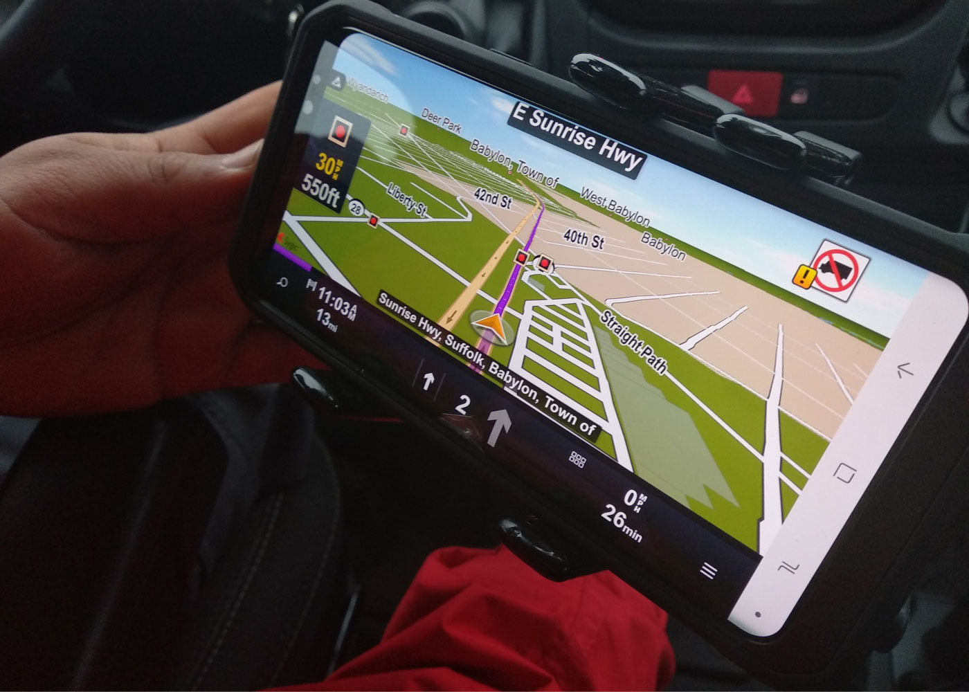
The most accurate ETA on the market based on historical speed profiles and real-time data.
Custom map overlays to visualize various layers
Visualize various GIS layers (e.g. infrastructure lines, pipe networks, unmapped roads, etc.).

Execute routes exactly as planned to save costs
Help drivers to drive the same routes as planned in the office and improve your cost planning.
Driver behavior evaluation
App-based driver scoring algorithm with automatic trip recognition is integrated in Sygic Professional Navigation.
It is ready to use as the data can be collected and analysed using web API allowing fleets to create driver scoreboards without costly hardware implementation.
Learn more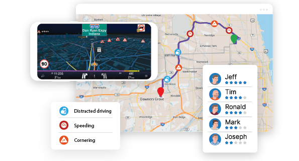
Send destination directly into navigation
3rd party Fleet management app can set destination of the next intervention into the Sygic navigation app. Sygic then calculates the route to the next delivery taking into consideration vehicle parameters and restrictions.
The destination can be set either as address, GPS coordinates or what3words Address.
The Royal Dutch Touring Club is responsible for traffic signs and signage on roads and trails. Sygic is integrated to the dashboard of 1000 ANWB vehicles to support efficient road assistance services by aunching navigation to correct destination.

Send the day's itinerary into navigation
It is possible to send optimized itineraries to the driver in 2 ways:
Send optimized sequence of waypoints, including time windows, (AddItinerary) and let the Sygic routing engine (considering vehicle parameters vehicle parameters) to transform day plan into a route.
The second option is Sygic Guided routes feature offers the possibility to import entire routes from your planning tool into Sygic Professional Navigation. The navigation suppresses its own routing algorithm and rather accepts the directions provided by the planning tool. This way driver follows the route exactly as planned.

Navigation was integrated with myAVIS® Field Service by KVADOS to help ČEZ service technicians to react quickly by sending correct destination to the navigation. Service technicians can see the day's route and are able navigate through the unfamiliar terrain to their specific job just by pressing one button.
Keep navigating when offline
Service fleets often need to reach exact location in the remote areas without or with poor data coverage.
Sygic Professional Navigation with maps installed locally on device offers the reliable service and keeps navigation also when data are not available.
Search, custom POIs (company assets like high voltage towers)and historical traffic data are also available offline.
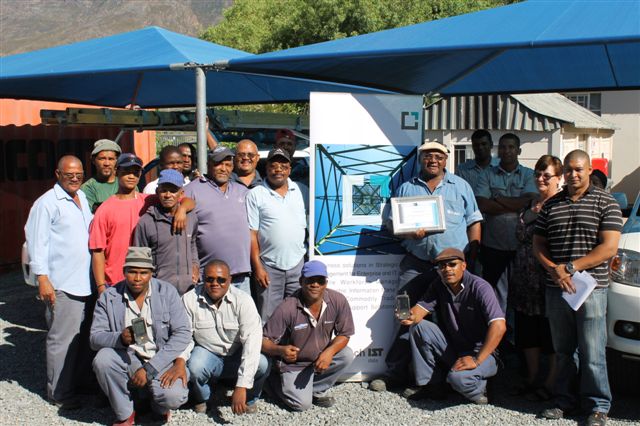
Sygic Professional Navigation integrated with IST's workforce management system helps 5000 technicians of South African electricity public utility Eskom to find the correct location even when data coverage is not available.
Getting company roads and assets on the map
The Sygic Professional Navigation software can visualize and work with various GIS layers (e.g. infrastructure lines, pipe network, or unmapped roads, etc.) on the navigation map using the custom geometry files.
It is possible to add custom points of interest (POIs) to the navigation maps. You can very easily find the nearest POI from your current position and get navigated to this waypoint.
Companies, which need to navigate their drivers on roads not mapped on standard maps, such as private or lease roads, can import their map content onto Sygic Professional Navigation and provide driver with voice-guided navigation from the city directly to assets on their own roads like for example oil wells.

The Sygic Navigation software allows Endesa technicians to find and reach service sites more quickly and more precisely by getting navigated directly to company assets imported into map.
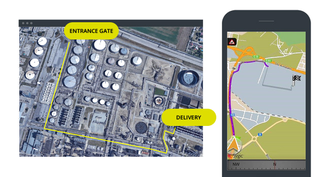
Last mile off-road
The feature called “Last mile off-road,” or as some might call it “Yard navigation,” will help all truck drivers to get oriented within an unmapped area of any factory. Sygic Professional Navigation can get a truck driver to the entrance gate of this area, and continue to the point, where the truck needs to be loaded/unloaded for instance.
Learn more
Irbid Electricity Company recently introduced their new innovative software featuring Sygic Professional Navigation to improve performance of its on-field operations. In this way we reduced the mistaken address inputs and additional kilometers. Sygic is easy to use, modern and very fast navigation app, essential for professional drivers working in field operations.
Send preplanned routes directly to your drivers and control the number of kilometres driven
Plan exact routes in your planning tool and send them to the Sygic Professional Navigation app for execution, taking restrictions based on truck, HAZMAT, and other settings into account. Helping drivers to drive the same routes as planned in the office enables you to get much better results in terms of planned versus driven kilometres and avoid fuel cost estimation discrepancies.
Learn more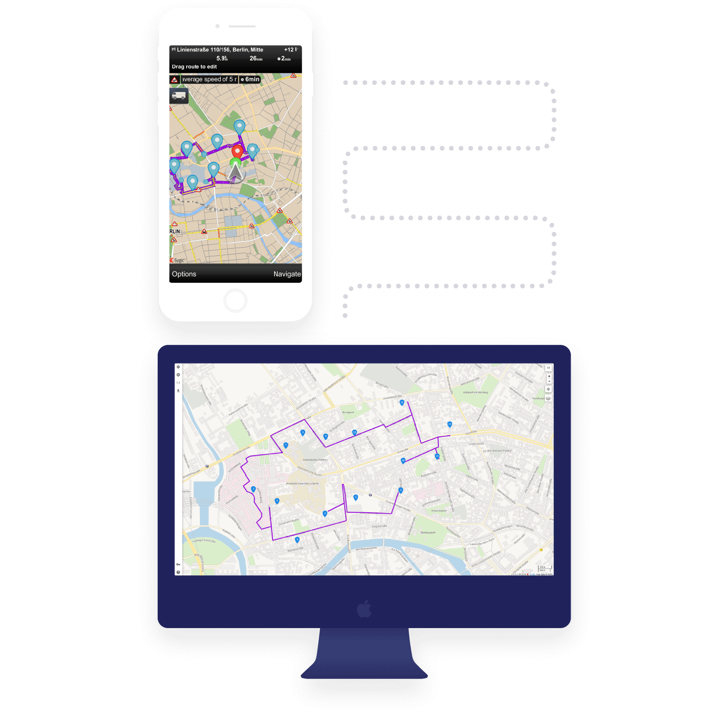
Customisations for field service management
Bigger projects may require functionality that is not part of the standard Sygic Professional Navigation package. In this case Sygic provides professional technical support to developers and software vendors for integration and on-demand customization requirements.
A leading North American satellite television provider integrates Sygic Professional Navigation into field service management solution from Oracle. Besides the sending destination, particular Dish field operations required several customizations of Sygic Professional Navigation:
- launch navigation without user interaction in order to reduce mistaken addresses inputs,
- earlier next turn instructions, and
- customized map content to avoid parkways.
Let's Talk
Need a quote?
Want to try out the solution?
Need expert guidance?
Fill out this form, and we'll get back to you as soon as we can.
Not here for business?
Hop into our Support Center.